Using GPS with RISC OS
|
|
Another advantage of GPX as a geodata format is that it can include timings for the way points, and can distinguish between tracks (recorded from live signals) and routes (which might be planned by mapping software). As an XML format, it is possible to incorporate extension data too. |
|
|
I hope the GPS ot the Pyra 4G will work (and the 4G too :) ) |
|
|
The developer use the same hardware like Willi for his OMAP5 port. Not sure how 3G/4G and GPS is implemented. I hope also it will work. |
|
|
I am trying to set the default starting coordinates (ie no GPS) to 41.43428 S and 147.12844 E. I modified the line but am having difficulties getting the correct latitude- Can SatNav handle negative coordinates or is it Northern Hemisphere only? |
|
|
If you look at the next few lines you will see that only positive lat & long is allowed, with either N or S or E or W to indicate negative values. |
|
|
Send a question to Nikolaus… The answer sounds nice. G3/4 and GPS is handle like a USB device and usable via PPP (same like a Surfstick), via special USB commands (not needed) and via UART (if Bluetooth is off… easy with RISC OS ;-)). The Pandora UART I use for GPS… works. |
|
|
I probably find my future laptop, GPS and organizer. |
|
|
Chris thanks for the quick reply. Can’t wait for my GPS shield to arrive. |
|
|
GPS works also with my PiTab |
|
|
Am trying SatNav with a cheaper (£16) GPS module from Makerisfy. So far it is receiving messages – the Pi is connected to the Internet and it confirms the time is correct (between 8cs and 14cs fast) – but I can’t get it to fix location despite tracking 5 satellites with 16 in view. I think I need to send it a message but ran out of time to experiment. |
|
|
Have play around with the smaller “Adafruit Ultimate GPS” but… |
|
|
I have ordered one for my next trial so I hope to get it working quite soon (meanwhile updated to version 0.89 following comments at the show). Much more convenient size. Still working on the cheaper one… |
|
|
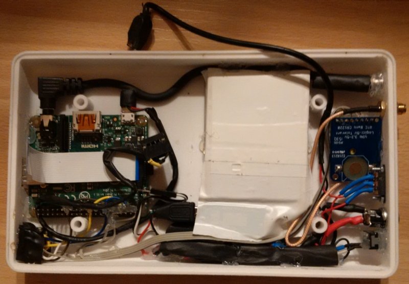
I have a bit more “play around” with the smaller module on my Pandora and have take look at the datasheets. Many words for … it works!!! Is usable with SatNav. Edit: Now it is inside my PiTab…
|
|
|
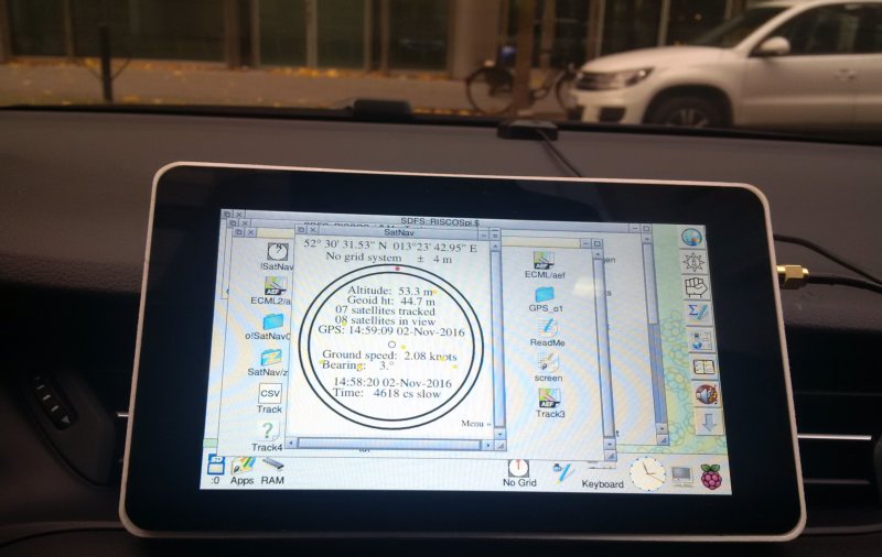
Near ready. Any cosmetical things needed. Have record my way to work. Works fine.
|
|
|
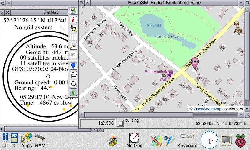
SatNav is now at version 1.00. It provides a real time clock value within a few seconds of switch on, whether or not it can see any satellites – the GPS module has a small battery to keep time whilst switched off. It can also provide GPS location updates (via a messaging system developed in conjunction with RiscOSM) every 1s, 2s, 5s or 10s. It can record a track and export it in GPX or AEF format. It can also support an I2C-connected 16×2 text display so that a small portable unit can operate with no need for a screen, or for that matter any user input. As it seems to use only about 100mA I don’t think I’ll bother to fit a switch for the backlight (it can be controlled in software, but with no user intervention otherwise, it is difficult to see the need). A detailed write-up is in Archive magazine 24:2 which was available at the London show (ignore the bit about GPS satellites being in geostationary orbit – they are 20km up and orbit twice a day but my correction missed the deadline). |
|
|
Just installed my new Adafruit ultimate GPS shield into the pi-top and after wandering around the street like a pokemon go addict for 15 minutes SatNav was in business and placed me correctly on a RiscOSM map. Thanks Chris for creating such a great product and to Raik for sharing your progress on such a range of devices. |
|
|
Wow…
|
|
|
after wandering around the street like a pokemon go addict for 15 minutes SatNav was in business and placed me correctly on a RiscOSM map if you put a CR1220 battery in the GPS module, you should get a much more rapid fix next time you turn it on. Have try SatNav0.90Version 1.00 overcomes an occasional problem with the serial port which I don’t understand (now posted a Bug report) which causes SatNav either to wait in a loop for a character or (which I do understand and have corrected) to throw an error when EVAL is given some bad hex to check with the checksum. I have had version 1.00 on test now for some time. Currently doing an endurance test with a 5200mAh battery with the Pi Zero + GPS module + external antenna + 16×2 character screen (with backlight lit) which is consuming 760mW (about 153mA) giving a continuous position fix plus speed and time readout. |
|
|
I have just downloaded version 1.00 and can report it as working with my Iyonix-Garmin GPSmap 60CSx. The NMEA mode only supports 4800 so I changed the 7 to a 6 and seems OK. Edit: No tweaking required, the handset was in autopilot mode and was only sending a subset of nmea sentences. So now I have it all, I think 43 30’ 55.69" S 172 38’ 09.05" E |
|
|
Nice to see that it works in Christchurch, NZ, half way between St Albans and Edgeware. |
|
|
Chris thanks for the tip, fitting a battery into the GPS module did help to reduce the time taken to get a fix.
Also works in Launceston, Tasmania |
|
|
I wired up my older Garmin GPS128 this morning and there was resistance to getting the serial stream with SatNav and Colin’s SerialTerminal. |
|
|
If you save the status window from SatNav as a Draw file, it will show the last eight NMEA messages received. You will need to view the draw file in Draw or PhotoDesk as Impression and Artworks cannot display draw files correctly that use certain features (text area objects) which have been documented since the July 1989 PRMs. As some parts of the saved Draw file are in negative height, you’ll either need to select all and drag them up (in Draw, PhotoDesk is OK), use !MultiTask and ‘zerosave’ the draw file (move the minX,minY to be zero) or just view the end of the saved draw file in a text editor. After testing version 1.00 of SatNav by being driven around in someone else’s car, a few minor bug fixes have come to light (two bugs affecting display of speed via I2C on a 16×2 text display and one bug where tracking to an external file did not take place if using RiscOSM version 1.40 (which uses a messaging protocol rather than the more primitive URI_Dispatch geo: call) so version 1.01 has been released. |
|
|
If you save the status window from SatNav as a Draw file, it will show the last eight NMEA messages received. Thanks that should be a good indication of the serial flow. |
|
|
If your module behaves like my old Bluetooth GPS receiver…then that’s normal. The receiver will first be looking for satellites. Then it will know how many it can see, then it will know their identities, then it will know their positions, then it can calculate a position for you. |


